El Torcal de Antequera
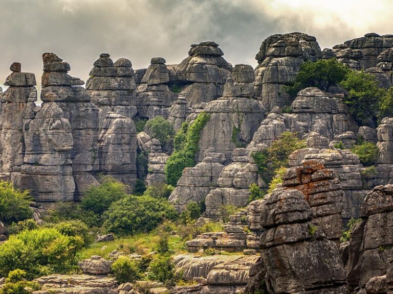
El Torcal de Antequera is a limestone plateau south of Antequera where rain, frost and wind have carved Jurassic rock into stacked blocks and towers over 1,200 m above sea level.
About El Torcal de Antequera
El Torcal covers about 17 km² of the Sierra del Torcal, a few kilometres south of Antequera. Its limestone formed on the bed of the Tethys sea around 150 million years ago, in the Jurassic, and was later lifted and cracked. Rain, frost and wind widened the joints into rounded, stacked blocks. The highest point, Camorro de las Siete Mesas, reaches 1,336 m.
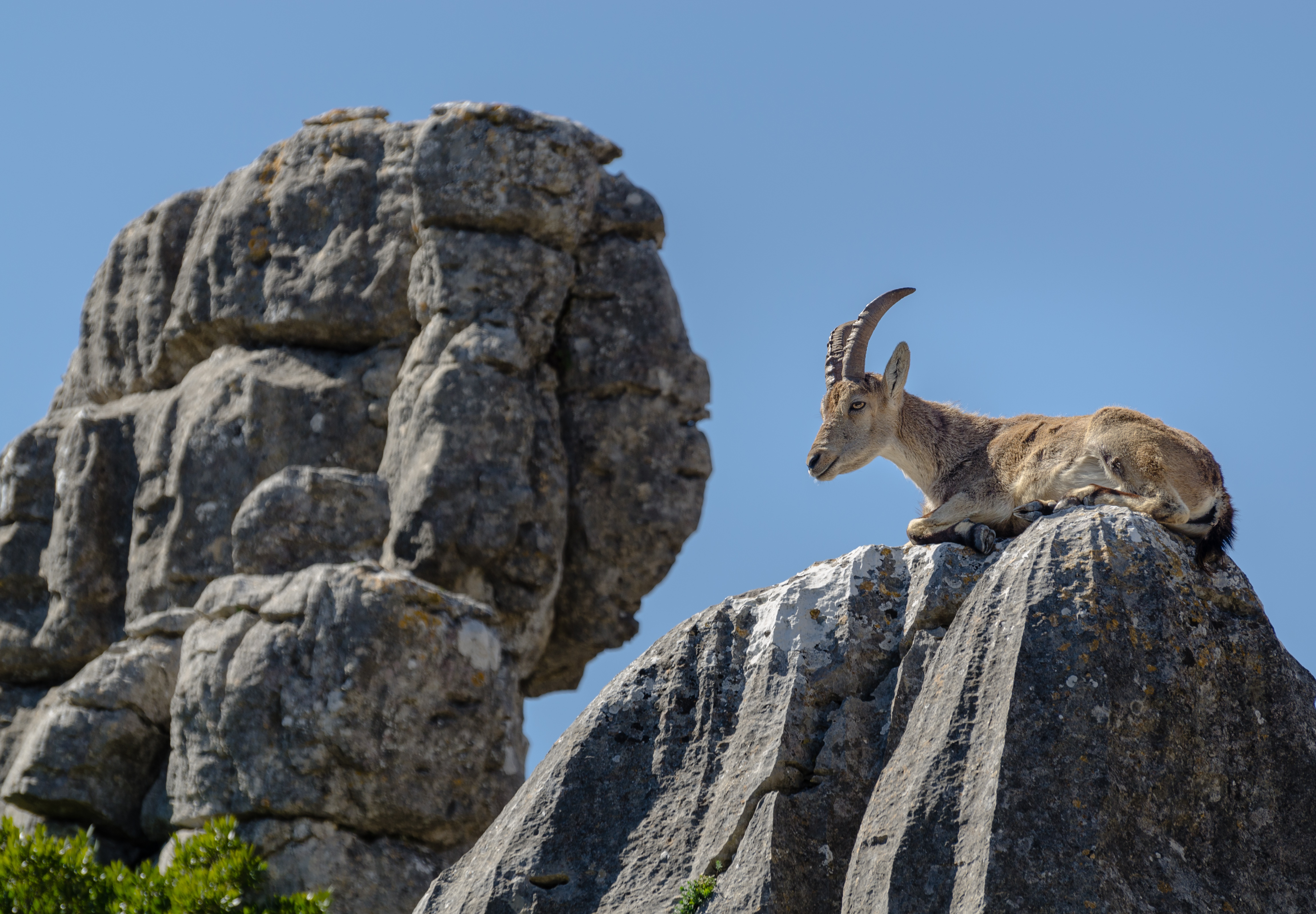
From the visitor centre, the Green Route is a 1.5 km loop of about 45 minutes and the Yellow Route a 3 km loop of around 2 hours deeper into the maze. Rocks carry names such as El Tornillo, the screw, now a natural monument. Spanish ibex graze the ledges, griffon vultures pass overhead and about thirty kinds of orchid grow here.
The natural area, visitor centre and three signposted trails are free, with no permit needed. Paths are rocky and uneven, fine for children and reasonably fit walkers in proper shoes; only two short paths, 100 m to the Ventanillas viewpoint and 500 m to El Tornillo, suit wheelchairs and pushchairs. There is no public transport, and when the upper car park fills at busy weekends a shuttle runs from the lower one for €3 return.
Spring and autumn are best, with flowers from April; summer middays are hot and exposed, and low cloud can cover the plateau. Arrive early to drive straight to the top.
El Torcal de Antequera in pictures

What you’ll find
- Café or kioskFood and drinkBuy
- Car parkParkingFree
- Guided walkGuided walkBook
- Hiking trailHikingFree
- ViewpointSightseeingFree
- Visitor centreVisitor information (09:30–17:00)Free
Nearby places to visit
Antequera lies to the north, below the sierra. In town, the Alcazaba and Colegiata of Antequera (7 km) pairs a Moorish fortress with the early Renaissance Real Colegiata de Santa María, and the El Henchidero Textile Museum (7 km) recreates the looms of a former weaving factory. On the edge of town, the Dolmens of Antequera (8 km), Menga, Viera and El Romeral, were inscribed by UNESCO in 2016, and the Peña de los Enamorados (8 km), the crag shaped like a face lying back, belongs to the same World Heritage Site. Campo de Golf Antequera (9 km) lies on the plain to the north-west, among olives, holm oaks and lakes.
El Torcal de Antequera at a glance
Town
Antequera
Address
Centro de Visitantes Torcal Alto, Ctra. de acceso al Torcal Alto km 3.5, 29200 Antequera, Málaga, Spain
Opening hours
Natural area open access. Torcal Alto visitor centre daily 09:30–17:00; 24 and 31 December and 5 January 10:00–14:00; closed 25 December, 1 and 6 January.
Prices
Free; shuttle from the lower car park €3 return when the upper car park is full
Checked 1 Nov 2026 on the official website. Times and prices can change, so confirm before you go.
Website
torcaldeantequera.com
Phone
+34 952 24 33 24
Tours nearby
Guided tours that visit Antequera and elsewhere in Málaga.